
Drone Pipeline Inspections in Oil and Gas Industry
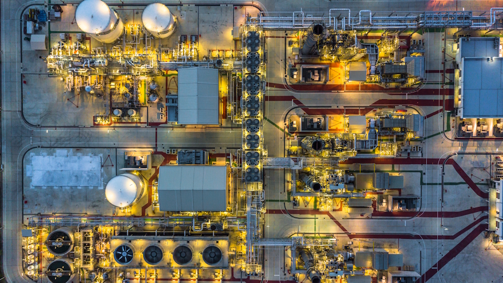
The oil and gas industry relies on a vast network of pipeline infrastructure to transport crude oil and natural gas across the country. Regular inspection of these pipelines is critical for detecting leaks, preventing accidents, and avoiding environmental disasters.
In recent years, drones have emerged as an invaluable tool for streamlining pipeline inspections. Compared to traditional methods, drones in oil and gas offer huge advantages in efficiency, safety, and data collection.
We will explore all the key factors involved in leveraging drone technology for pipeline surveys. Whether you are a pipeline operator, service provider, regulator, engineer, or pilot, this article covers everything you need to know.
Overview of Oil and Gas Pipeline Infrastructure
The world’s biggest network of energy pipelines belongs to the United States. This includes:
- Over 210 natural gas pipeline systems spanning over 300,000 miles.
- Over 200,000 miles of liquid petroleum pipelines.
This massive pipeline network transports natural gas, crude oil, and refined products like diesel, gasoline, diesel, and jet fuel across the country.
The pipeline system starts with thousands of oil and gas wells that extract crude oil or raw natural gas from underground deposits. The oil and gas are separated and then transported through large transmission pipelines to refineries for processing.
From there, refined fuels are distributed through smaller pipelines that connect to individual cities, businesses, and homes. Along the way, compressor stations and pumping stations help pressurize and push the oil and gas through the pipes.
Most pipeline infrastructure in the US is buried underground, making it difficult to access and inspect regularly.
The Critical Importance of Pipeline Monitoring
Routine inspection is essential for ensuring pipeline integrity and preventing leaks, ruptures, or explosions. Here’s why consistent monitoring is so important:
Prevent Corrosion Damage
Corrosion is the leading cause of pipeline failures, responsible for nearly 25% of all incidents. It can gradually wear away the metal over time. Inspections allow corrosion to be detected early before it leads to a leak or rupture.
Identify Physical Damage
Physical damage from excavations, natural disasters, or mechanical issues can also cause pipeline problems. Inspections help spot dents, cracks, leakage, gas leak and other defects before they become dangerous.
Reduce Environmental Impact
Pipeline leaks can spill crude oil or other hazardous liquids into the environment. Just a small 1% leak in a large pipeline could spill over 450,000 barrels per year. Regular inspection minimizes the chance of major spills.
Avoid Explosions
Natural gas is highly combustible. A damaged pipeline can lead to devastating explosions like the 2018 incident in Beaver County, Pennsylvania. Inspection is vital for preventing loss of life and property.
Meet Regulatory Requirements
Pipeline operators must comply with inspection requirements from regulators like the (PHMSA) Pipeline and Hazardous Materials Safety Administration. More frequent inspections using drones can help meet and exceed regulatory standards.
Lower Risk
Overall, routine inspection reduces the operational and environmental risks associated with transporting combustible fuel through pipelines. Drone technology makes this process faster, cheaper, and more efficient.
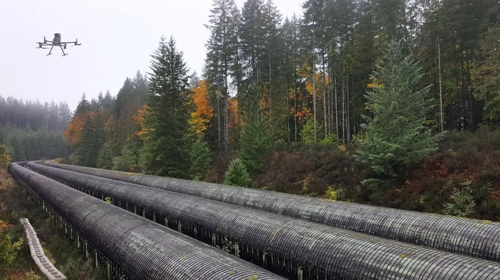
How Drones Are Transforming Pipeline Inspections
The oil and gas industry is quickly adopting drone technology for all aspects of operations, including pipeline inspections. Major companies using drones for pipelines include BP, Shell, Kinder Morgan, Colonial Pipeline Company, Plains All American Pipeline, Enbridge Energy, and many more.
Drones provide clear benefits over traditional pipeline inspection methods:
Faster inspections – Drones can cover hundreds of miles in a single flight. Infrastructure that took weeks to inspect manually can now be surveyed in a few hours.
Safer inspections – Drones eliminate the need to place inspectors in hazardous environments near pipelines. Worksites are safer without personnel on the ground.
Lower cost – One drone can do the work of a whole team of inspectors at a fraction of the price. No helicopters or ground crews needed.
Richer data – Drones with cameras and sensors can capture immense high-quality data above pipelines. This data can be analyzed to find defects.
Real-time monitoring – Live video feeds enable instant assessment of damaged pipelines after disasters. This allows faster emergency response.
Easier access – Drones can easily and safely access hard-to-reach parts of pipelines in remote or challenging terrain.
Equipped with cameras, LiDAR sensors, thermal imaging, gas sniffers, and other technology, drones are set to completely transform the pipeline inspection process.
Traditional Pipeline Inspection Methods
Before the rise of drones, pipeline monitoring relied on a combination of ground patrols, fixed-wing aircraft, helicopters, and inline inspection tools. Let’s look at the pros and cons of conventional techniques:
Ground Patrols
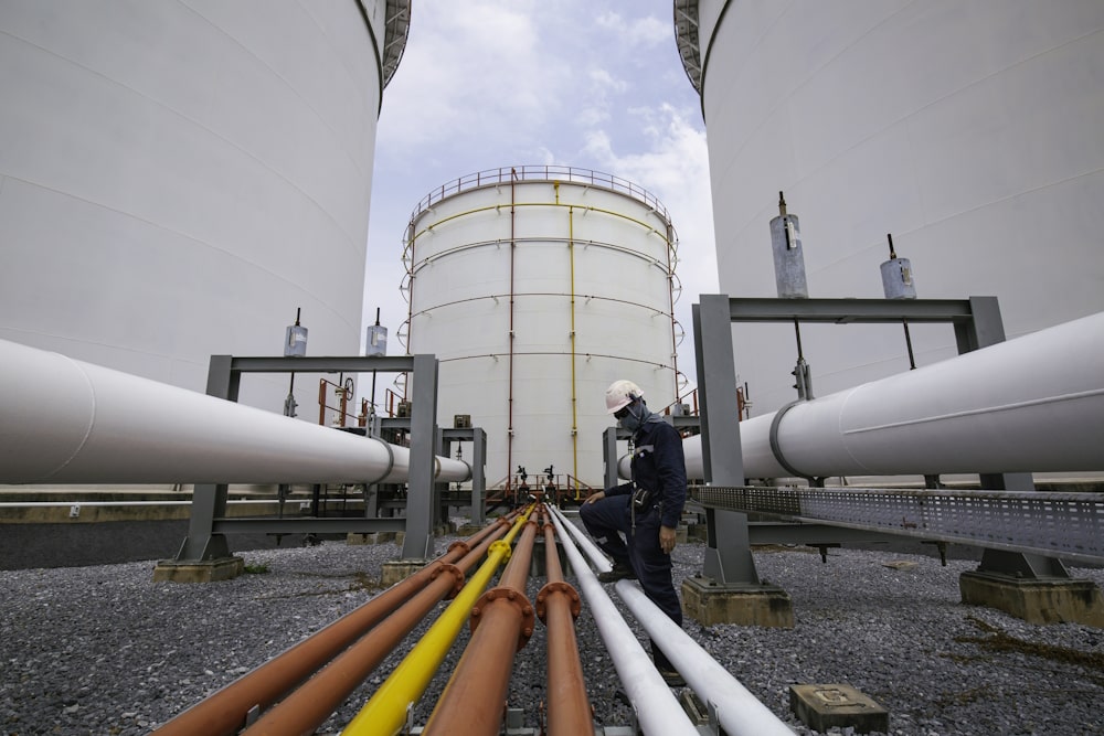
Teams inspect pipelines by foot while using leak detection equipment and visually checking for damage.
Pros: Direct access for detailed inspections, portable sensors detect leaks
Cons: Very slow (5-6 miles per day), significant safety risks, difficult terrain access
Manned Aircraft
Helicopters and fixed-wing planes perform aerial patrols of pipeline routes. Some use infrared, LiDAR, or other advanced imaging.
Pros: Covers more area than ground patrols, advanced sensors available
Cons: Expensive ($300-$3000/hour), limited visual detail, scheduling delays
Inline Inspection Tools
Also known as “smart pigs,” these sensor robots travel inside the pipeline to look for corrosion and defects.
Pros: Detailed internal view, good for assessing corrosion
Cons: Only suitable for large pipelines, requires pipeline downtime
While these methods are still useful, drones provide the best combination of safety, efficiency, rich data collection, and ease of deployment.
5 Key Benefits of Using Drones for Pipeline Inspections
From small quadcopters to fixed-wing systems, drones tailored for pipeline surveys offer major advantages across the board:
1. Faster Inspections and Increased Coverage
Drones equipped with high-resolution cameras can easily cover hundreds of miles of pipeline in a single flight. For example, at a 70 mph cruise speed, a fixed-wing UAV can inspect 20 miles of pipeline in just 20 minutes.
This enables vastly more regular inspections. Areas that were surveyed by helicopter once a year can now be checked every month. More frequent monitoring directly improves pipeline safety and leak prevention.
2. Safer and More Efficient Surveys
Drone pipeline inspections remove the need to place inspectors in unsafe environments near active pipelines. Drones face no risk inspecting disaster areas, rugged terrain, or remote infrastructure.
They also eliminate the cost and dangers associated with using manned helicopters and airplanes. One pilot can oversee an entire fleet of drones and conduct multiple simultaneous inspections.
3. Detailed Imagery and Sensing
High-resolution cameras on drones can spot small defects and anomalies that would be impossible for the naked eye. Objects as small as 1-2 inches can be identified from 200 ft altitude with specialized zoom and scanning cameras.
Thermal, multispectral, hyperspectral, LiDAR, and gas sensors provide immense amounts of pipeline condition data for analysis. Artificial intelligence then automatically flags potential threats.
4. Rapid Emergency Response
After fires, floods, earthquakes, and other disasters that may affect buried pipelines, drones allow first-responders to safely assess damages in real-time. This is crucial for controlling leaks and preventing explosions.
5. Improved Planning and Analysis
Drone data gets incorporated into pipeline Geographic Information Systems (GIS). This provides current, accurate views of pipeline routes, encroachments, terrain, and surrounding environment.
Analysis of drone data combined with historical records improves risk management, maintenance planning, and overall pipeline integrity management.
Key Challenges With Drones for Pipeline Inspections
While they offer immense benefits, drone-based surveys also come with some limitations:
Weather conditions – Most commercial drones cannot safely fly in heavy rain, snow, or wind, limiting some inspections. However, some heavy lift professional drones can handle worse weather.
Short battery life – Battery powered drones typically have 15-45 minutes of flight time depending on model and conditions. This can be managed by having replacement batteries and battery swap stations along the flight path.
Data processing – The huge data sets captured require sophisticated software to stitch photos together and analyze for defects using AI. Powerful hardware and specialized tools are needed to handle drone data.
Airspace restrictions – Certain no fly zones or restrictions around airports can limit drone pipeline surveys. Proper airspace authorizations are required for any commercial drone operation.
Overall though, the challenges are easily outweighed by the benefits of UAVs. As technology improves, the capabilities of drones for pipeline inspections will continue expanding.
Getting Started With Drone Pipeline Inspections
Interested in leveraging drones at your company or for a client? Here are the first steps to take:
Research and Select an Ideal Drone System
There are many drone models optimized for pipeline inspection. Consider your budget, required flight time, camera resolution, and other key factors when selecting a UAV. Popular choices include the DJI Matrice 300 RTK, senseFly eBee X, and Intel Falcon 8+.
Obtain Proper Training and Certifications
Pilots need an FAA Part 107 license at minimum to commercially operate drones in the US. Proper training tailored to pipeline missions is also ideal. Look for providers familiar with oil and gas drone operations.
Implement Drone Data Processing Software
To make the most of drone data, you’ll need software that can stitch photos together into detailed maps, analyze imagery with AI to identify defects, and integrate with maintenance systems. DroneDeploy is a popular choice.
Develop Operational Guidelines
Detail proper practices, safety protocols, flight patterns, weather limitations and other standards so inspectors follow the same methods. This ensures uniform, high quality data collection.
Consider Contracting With an Expert Provider
Specialty drone service firms already have certified pilots, proven hardware and software, and deep expertise inspecting pipelines across North America. This option avoids the challenges of building in-house drone inspection teams from scratch.
Following best practices combined with the latest UAV technology enables oil and gas companies to revolutionize how they monitor pipeline infrastructure. Drone-based surveys lead to improved safety and reduced risk across pipeline networks.
Drone Pipeline Inspection Case Studies
To understand the real-world benefits, let’s look at how two companies are using drones to better inspect pipelines:
Environmental Drone Company Detects Saltwater Leaks
Trinity Services and Consulting helps oil companies inspect produced water saltwater pipelines prone to leakage using drones with specialized sensors.
By using DroneDeploy to analyze vegetation health along 180 miles of pipeline, they identified potential leak points for just $5000. This early leak detection capability saves millions in clean-up costs and protects farmland.
Trinity is able to monitor pipelines for leaks with 90% less cost than manual methods using drone technology. Their drone surveys minimize environmental impact and reduce risk for oil company clients.
China Gas Firm Inspects Over 100 Miles in One Day
Working with DJI Enterprise, China’s national oil and gas firm PipeChina leveraged industrial drones to inspect over 110 miles of natural gas pipeline in just a single flight.
By using advanced software capabilities, a remote pilot was able to control the automated drone inspection in real-time from miles away. This allowed the team to assess the pipeline safely and efficiently.
The project demonstrated how large-scale linear infrastructure inspections are being transformed by commercial drone systems with sophisticated imaging payloads.
Frequently Asked Questions
What sensors and cameras are used on pipeline inspection drones?
Common sensors include high-resolution visual cameras, thermal cameras, multispectral cameras, LiDAR for 3D modeling, and methane detectors or sniffers. These allow drones to identify leaks, corrosion, encroachments, terrain changes, and more.
How are drone inspections regulated in the US?
The FAA regulates all commercial drone operations. Pilots need a Part 107 license and aircraft must be registered. Flights near airports or in certain airspaces require additional waivers and permissions.
How does drone data get turned into usable information?
Specialized software stitches drone photos together and overlays them on maps. Artificial intelligence algorithms then analyze imagery to detect corrosion, leaks, construction, and other integrity threats. This data integrates with maintenance software.
What are the FAA regulations for long distance pipeline inspections?
Pilots must maintain visual line-of-sight under Part 107 rules. To go beyond visual range, operators need special FAA waivers like those for Extended Visual Line of Sight (EVLOS) or Beyond Visual Line of Sight (BVLOS) flights.
Do I need aviation experience to pilot drones for pipeline surveys?
Not necessarily. Anyone can get trained and certified for commercial drone operation without traditional aviation experience. However, an aeronautics background is certainly helpful for skilled pipeline inspection work.
Key Takeaways
- Regular inspection is crucial for pipeline integrity and safety. Drone technology has revolutionized how pipelines are monitored.
- Compared to ground patrols, manned aircraft, and inline tools, drones provide huge benefits in efficiency, safety, cost, data collection, and accessibility.
- Major oil and gas firms are adopting drones for faster, cheaper, and more frequent pipeline surveys.
- Despite some limitations, drone-based inspections minimize risk, maximize coverage, and improve emergency response capabilities.
- With proper training, UAV selection, data processing, and procedures, organizations can implement drone-based pipeline inspection programs.
- Contracting with specialized drone service providers is the fastest way to benefit from UAV surveys.
Adopting drones from construction through operations is critical for oil and gas companies to reduce costs, enhance safety, comply with regulations, and minimize environmental impact. Drone-based pipeline inspection has become an indispensable tool for modern pipeline management.
- Drone Pipeline Inspections in Oil and Gas Industry - November 23, 2023
- Wind Turbine Inspection using Drones - November 16, 2023
- Agriculture Drone Mapping: Data-Driven Decisions - October 29, 2023